
Topografische kaart Chorabari Glacier
Interactieve kaart
Klik op de kaart om de hoogte weer te geven.
Over deze kaart
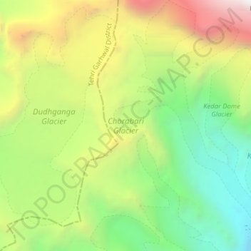
Naam: Topografische kaart Chorabari Glacier, hoogte, reliëf.
Gemiddelde hoogte: 5.011 m
Minimale hoogte: 3.854 m
Maximale hoogte: 6.813 m
Andere topografische kaarten
Klik op een kaart om zijn topografie, zijn hoogte en zijn reliëf te bekijken.
Lake Vasuki Tal
India > Uttarakhand > Ukhimath > Kedarnath
Lake Vasuki Tal, Kedarnath, Ukhimath, Rudraprayag District, Uttarakhand, India
Gemiddelde hoogte: 4.303 m