
Topografische kaart Villahermosa
Interactieve kaart
Klik op de kaart om de hoogte weer te geven.
Over deze kaart
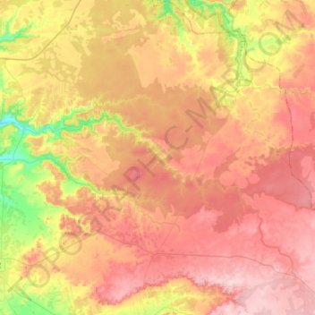
Naam: Topografische kaart Villahermosa, hoogte, reliëf.
Gemiddelde hoogte: 924 m
Minimale hoogte: 798 m
Maximale hoogte: 1.017 m
Situada a 956 metros de altitud. El punto más alto de su término municipal se encuentra a 1017 msnm en el lugar llamado "Vacanás".