
Topografische kaart Batán
Interactieve kaart
Klik op de kaart om de hoogte weer te geven.
Over deze kaart
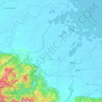
Naam: Topografische kaart Batán, hoogte, reliëf.
Locatie: Batán, Cantón Matina, Provincia Limón, 70502, Costa Rica (9.98177 -83.46833 10.22175 -83.23697)
Gemiddelde hoogte: 69 m
Minimale hoogte: -1 m
Maximale hoogte: 756 m