
Topografische kaart Machilipatnam
Interactieve kaart
Klik op de kaart om de hoogte weer te geven.
Over deze kaart
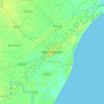
Naam: Topografische kaart Machilipatnam, hoogte, reliëf.
Locatie: Machilipatnam, Krishna, Andhra Pradesh, 521001, India (16.02174 80.97482 16.34174 81.29482)
Gemiddelde hoogte: 4 m
Minimale hoogte: -4 m
Maximale hoogte: 13 m
Machilipatnam city is at 16°10′N 81°08′E / 16.17°N 81.13°E / 16.17; 81.13 on the southeast coast of India and in the east coast of Andhra Pradesh. The city has an average elevation of 14 meters (45 feet).