
Topografische kaart Shaniko
Interactieve kaart
Klik op de kaart om de hoogte weer te geven.
Shaniko
The city is at an elevation of 3,343 feet (1,019 m). On the high plateau on which Shaniko was built, the soil is thin and the vegetation sparse, consisting mainly of sagebrush, bunchgrass, and occasional junipers. Many peaks of the Cascade Range, including Hood, Jefferson, Adams, St. Helens and Rainier, are visible from the city.
Over deze kaart
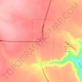
Naam: Topografische kaart Shaniko, hoogte, reliëf.
Locatie: Shaniko, Wasco County, Oregon, United States (44.99660 -120.75733 45.01082 -120.74709)
Gemiddelde hoogte: 1.009 m
Minimale hoogte: 900 m
Maximale hoogte: 1.038 m