
Topografische kaart Kianinny Bay
Interactieve kaart
Klik op de kaart om de hoogte weer te geven.
Over deze kaart
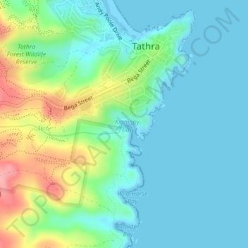
Naam: Topografische kaart Kianinny Bay, hoogte, reliëf.
Gemiddelde hoogte: 29 m
Minimale hoogte: -1 m
Maximale hoogte: 110 m
Andere topografische kaarten
Klik op een kaart om zijn topografie, zijn hoogte en zijn reliëf te bekijken.
Tathra
Australia > New South Wales > Tathra
Tathra, Bega Valley Shire Council, New South Wales, Australia
Gemiddelde hoogte: 23 m
Bega River
Australia > New South Wales > Tathra > Chinnock
Bega River, Chinnock, Tathra, Bega Valley Shire Council, New South Wales, 2550, Australia
Gemiddelde hoogte: 46 m