
Topografische kaart Barters Island
Interactieve kaart
Klik op de kaart om de hoogte weer te geven.
Over deze kaart
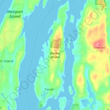
Naam: Topografische kaart Barters Island, hoogte, reliëf.
Gemiddelde hoogte: 18 m
Minimale hoogte: -1 m
Maximale hoogte: 72 m
Andere topografische kaarten
Klik op een kaart om zijn topografie, zijn hoogte en zijn reliëf te bekijken.
East Boothbay
United States > Maine > Lincoln County > Boothbay
East Boothbay, Boothbay, Lincoln County, Maine, 04568, United States
Gemiddelde hoogte: 16 m
Cabbage Island
United States > Maine > Lincoln County > Boothbay
Cabbage Island, Boothbay, Lincoln County, Maine, 04538, United States
Gemiddelde hoogte: 17 m