
Topografische kaart Sand Point
Interactieve kaart
Klik op de kaart om de hoogte weer te geven.
Over deze kaart
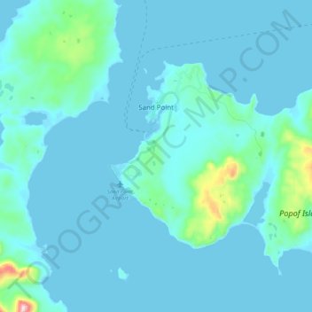
Naam: Topografische kaart Sand Point, hoogte, reliëf.
Locatie: Sand Point, Aleutians East, Alaska, 99661, United States (55.26620 -160.58040 55.37972 -160.45914)
Gemiddelde hoogte: 39 m
Minimale hoogte: -6 m
Maximale hoogte: 503 m