
Doe een donatie
Rust jezelf uit voor je volgende avontuur:
Als Amazon-partner verdient deze site een commissie op in aanmerking komende aankopen, zonder extra kosten voor jou.
Topografische kaart Wells
Klik op de kaart om de hoogte weer te geven.
Doe een donatie
Rust jezelf uit voor je volgende avontuur:
Als Amazon-partner verdient deze site een commissie op in aanmerking komende aankopen, zonder extra kosten voor jou.
Wells
Wells doesn't have a weather station, but Barkerville does (located 7 km (4.3 mi) away). Wells has a subarctic climate (Köppen climate classification Dfc), resulting in long, cold and snowy winters, accompanied by short and cool summers due to its high altitude and latitude. Its growing season averages only 66 days. It is located at the mouth of Jack of Clubs Creek, and defined as the source of the Willow River at the outflow of the Jack of Clubs Lake.
Doe een donatie
Rust jezelf uit voor je volgende avontuur:
Als Amazon-partner verdient deze site een commissie op in aanmerking komende aankopen, zonder extra kosten voor jou.
Over deze kaart
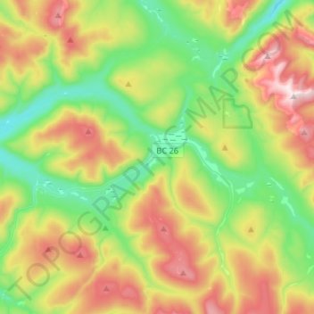
Naam: Topografische kaart Wells, hoogte, reliëf.
Gemiddelde hoogte: 1.439 m
Minimale hoogte: 1.112 m
Maximale hoogte: 1.982 m
Doe een donatie
Rust jezelf uit voor je volgende avontuur:
Als Amazon-partner verdient deze site een commissie op in aanmerking komende aankopen, zonder extra kosten voor jou.
Andere topografische kaarten
Klik op een kaart om zijn topografie, zijn hoogte en zijn reliëf te bekijken.
Bouchie Lake
Canada > British Columbia > Cariboo Regional District > Area B (Quesnel West/Bouchie Lake)
Gemiddelde hoogte: 699 m
Cottonwood River
Canada > British Columbia > Cariboo Regional District > Area C (Bowron Lake/Barlow Creek/Barkerville)
Gemiddelde hoogte: 799 m
Horse Lake
Canada > British Columbia > Cariboo Regional District > Area K (East Chilcotin)
Gemiddelde hoogte: 1.938 m
Lac La Hache
Canada > British Columbia > Cariboo Regional District > Area G (Lac La Hache/108 Mile Ranch)
Gemiddelde hoogte: 847 m
Doe een donatie
Rust jezelf uit voor je volgende avontuur:
Als Amazon-partner verdient deze site een commissie op in aanmerking komende aankopen, zonder extra kosten voor jou.
Barkerville
Canada > British Columbia > Cariboo Regional District > Area C (Bowron Lake/Barlow Creek/Barkerville)
Barkerville has a subarctic climate (Köppen climate classification Dfc), which makes it have long, cold and snowy winter and short and cool summers due to its high altitude and latitude. Its growing season averages only 66 days.
Gemiddelde hoogte: 1.435 m
Lone Butte
Canada > British Columbia > Cariboo Regional District > Area L (Lone Butte/Interlakes)
The northward advance of the Pacific Great Eastern Railway (PGE) rail head passed through Lone Butte in late April 1919. This construction camp had a large kitchen employing 25 cooks, of whom two received the Distinguished Conduct Medal and three the Military Medal during World War I. At an elevation of about…
Gemiddelde hoogte: 1.159 m
150 Mile House
Canada > British Columbia > Cariboo Regional District > Area F (Horsefly/Likely/150 Mile House)
Gemiddelde hoogte: 789 m
Twan Lake
Canada > British Columbia > Cariboo Regional District > Area K (East Chilcotin)
Gemiddelde hoogte: 941 m
Doe een donatie
Rust jezelf uit voor je volgende avontuur:
Als Amazon-partner verdient deze site een commissie op in aanmerking komende aankopen, zonder extra kosten voor jou.
Mount Juno
Canada > British Columbia > Cariboo Regional District > Area J (West Chilcotin)
Gemiddelde hoogte: 2.219 m
Kondor Lake
Canada > British Columbia > Cariboo Regional District > Area J (West Chilcotin)
Gemiddelde hoogte: 1.718 m
Valentine Lake
Canada > British Columbia > Cariboo Regional District > Area G (Lac La Hache/108 Mile Ranch)
Gemiddelde hoogte: 1.254 m
Anahim Lake
Canada > British Columbia > Cariboo Regional District > Area J (West Chilcotin)
Gemiddelde hoogte: 1.101 m
Doe een donatie
Rust jezelf uit voor je volgende avontuur:
Als Amazon-partner verdient deze site een commissie op in aanmerking komende aankopen, zonder extra kosten voor jou.
Williams Lake
Canada > British Columbia > Cariboo Regional District > Williams Lake
Gemiddelde hoogte: 854 m
Nazko
Canada > British Columbia > Cariboo Regional District > Area I (West Fraser/Nazko)
Gemiddelde hoogte: 891 m
Deka Lake
Canada > British Columbia > Cariboo Regional District > Area L (Lone Butte/Interlakes)
Gemiddelde hoogte: 1.141 m
Doe een donatie
Rust jezelf uit voor je volgende avontuur:
Als Amazon-partner verdient deze site een commissie op in aanmerking komende aankopen, zonder extra kosten voor jou.
Heckman Pass
Canada > British Columbia > Cariboo Regional District > Area J (West Chilcotin)
Gemiddelde hoogte: 1.519 m
Whitestone Lake
Canada > British Columbia > Cariboo Regional District > Area D (Commodore Heights/McLeese Lake)
Gemiddelde hoogte: 848 m
Alexis Creek
Canada > British Columbia > Cariboo Regional District > Area K (East Chilcotin)
Gemiddelde hoogte: 814 m
Elbow Lake
Canada > British Columbia > Cariboo Regional District > Area F (Horsefly/Likely/150 Mile House)
Gemiddelde hoogte: 959 m
Doe een donatie
Rust jezelf uit voor je volgende avontuur:
Als Amazon-partner verdient deze site een commissie op in aanmerking komende aankopen, zonder extra kosten voor jou.
Interlakes
Canada > British Columbia > Cariboo Regional District > Area L (Lone Butte/Interlakes)
Gemiddelde hoogte: 1.126 m
Mount Timothy
Canada > British Columbia > Cariboo Regional District > Area G (Lac La Hache/108 Mile Ranch)
Gemiddelde hoogte: 1.457 m
Big Creek
Canada > British Columbia > Cariboo Regional District > Area K (East Chilcotin)
Gemiddelde hoogte: 2.031 m
Horsefly
Canada > British Columbia > Cariboo Regional District > Area F (Horsefly/Likely/150 Mile House)
Gemiddelde hoogte: 807 m
Doe een donatie
Rust jezelf uit voor je volgende avontuur:
Als Amazon-partner verdient deze site een commissie op in aanmerking komende aankopen, zonder extra kosten voor jou.
Interior Plateau
Canada > British Columbia > Cariboo Regional District > Area A (Red Bluff/Quesnel South)
Gemiddelde hoogte: 828 m
Nazko Cone
Canada > British Columbia > Cariboo Regional District > Area I (West Fraser/Nazko)
Gemiddelde hoogte: 1.106 m
Itcha Range
Canada > British Columbia > Cariboo Regional District > Area J (West Chilcotin)
Gemiddelde hoogte: 1.747 m
Ilgachuz Range
Canada > British Columbia > Cariboo Regional District > Area J (West Chilcotin)
The Ilgachuz Range is a name given to an extinct shield volcano in British Columbia, Canada. It is not a mountain range in the normal sense, because it was formed as a single volcano that has been eroded for the past five million years. It lies on the Chilcotin Plateau, located some 350 kilometres (220 mi)…
Gemiddelde hoogte: 2.018 m
Doe een donatie
Rust jezelf uit voor je volgende avontuur:
Als Amazon-partner verdient deze site een commissie op in aanmerking komende aankopen, zonder extra kosten voor jou.
Rainbow Range
Canada > British Columbia > Cariboo Regional District > Area J (West Chilcotin)
Gemiddelde hoogte: 1.741 m
Nimpo Lake
Canada > British Columbia > Cariboo Regional District > Area J (West Chilcotin)
Gemiddelde hoogte: 1.131 m
Anahim Peak
Canada > British Columbia > Cariboo Regional District > Area J (West Chilcotin)
Gemiddelde hoogte: 1.416 m
Puntzi Mountain
Canada > British Columbia > Cariboo Regional District > Area J (West Chilcotin)
Gemiddelde hoogte: 1.293 m
Doe een donatie
Rust jezelf uit voor je volgende avontuur:
Als Amazon-partner verdient deze site een commissie op in aanmerking komende aankopen, zonder extra kosten voor jou.
Riske Creek
Canada > British Columbia > Cariboo Regional District > Area K (East Chilcotin)
Gemiddelde hoogte: 953 m
The Joker
Canada > British Columbia > Cariboo Regional District > Area J (West Chilcotin)
Gemiddelde hoogte: 2.157 m
Polley Lake
Canada > British Columbia > Cariboo Regional District > Area F (Horsefly/Likely/150 Mile House)
Gemiddelde hoogte: 1.022 m
Canim Lake
Canada > British Columbia > Cariboo Regional District > Area H (Canim Lake/Forest Grove)
Gemiddelde hoogte: 936 m
Doe een donatie
Rust jezelf uit voor je volgende avontuur:
Als Amazon-partner verdient deze site een commissie op in aanmerking komende aankopen, zonder extra kosten voor jou.
Black Lake
Canada > British Columbia > Cariboo Regional District > Area C (Bowron Lake/Barlow Creek/Barkerville)
Gemiddelde hoogte: 1.705 m
Mount Vic
Canada > British Columbia > Cariboo Regional District > Area K (East Chilcotin)
Gemiddelde hoogte: 2.556 m
Great Canyon
Canada > British Columbia > Cariboo Regional District > Area J (West Chilcotin)
Gemiddelde hoogte: 1.220 m
Blue Lake
Canada > British Columbia > Cariboo Regional District > Area A (Red Bluff/Quesnel South)
Gemiddelde hoogte: 781 m
Doe een donatie
Rust jezelf uit voor je volgende avontuur:
Als Amazon-partner verdient deze site een commissie op in aanmerking komende aankopen, zonder extra kosten voor jou.
Great Canyon
Canada > British Columbia > Cariboo Regional District > Area J (West Chilcotin)
Gemiddelde hoogte: 1.220 m
Antler Creek
Canada > British Columbia > Cariboo Regional District > Area C (Bowron Lake/Barlow Creek/Barkerville)
Gemiddelde hoogte: 1.021 m
Map Glacier
Canada > British Columbia > Cariboo Regional District > Area J (West Chilcotin)
Gemiddelde hoogte: 2.037 m