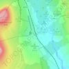
Topografische kaart Hanlith
Klik op de kaart om de hoogte weer te geven.
Over deze kaart

Naam: Topografische kaart Hanlith, hoogte, reliëf.
Locatie: Hanlith, North Yorkshire, England, BD23 4BP, United Kingdom (54.03510 -2.15604 54.06446 -2.11652)
Gemiddelde hoogte: 242 m
Minimale hoogte: 164 m
Maximale hoogte: 345 m
Andere topografische kaarten
Klik op een kaart om zijn topografie, zijn hoogte en zijn reliëf te bekijken.




Farndale
United Kingdom > England > North Yorkshire > Ryedale > Gillamoor
With the population having decreased greatly from the 668 that is recorded in "A Topographical Dictionary of Yorkshire" by Thomas Lansdale published in 1822 when farndale East side had a population of 455 and Farndale West Side had a Population of 213.
Gemiddelde hoogte: 273 m















Bolton Castle
United Kingdom > England > North Yorkshire > Redmire > Castle Bolton
Gemiddelde hoogte: 250 m


Thimbleby & Osmotherly Show field
United Kingdom > England > North Yorkshire > Thimbleby
Gemiddelde hoogte: 152 m









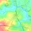
Killinghall
United Kingdom > England > North Yorkshire > Harrogate > Killinghall
Gemiddelde hoogte: 86 m



Ribblesdale
United Kingdom > England > North Yorkshire > Horton in Ribblesdale
Gemiddelde hoogte: 368 m