
Topografische kaart Młodojewo-Parcele
Interactieve kaart
Klik op de kaart om de hoogte weer te geven.
Over deze kaart
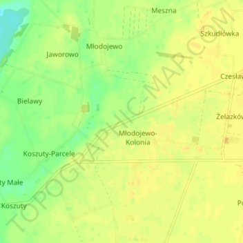
Naam: Topografische kaart Młodojewo-Parcele, hoogte, reliëf.
Gemiddelde hoogte: 97 m
Minimale hoogte: 83 m
Maximale hoogte: 104 m
Andere topografische kaarten
Klik op een kaart om zijn topografie, zijn hoogte en zijn reliëf te bekijken.
Bielsko
Poland > Greater Poland Voivodeship > Słupca County
Bielsko, gmina Orchowo, Słupca County, Greater Poland Voivodeship, 62-436, Poland
Gemiddelde hoogte: 107 m
Meszna
Poland > Greater Poland Voivodeship > Słupca County
Meszna, gmina Słupca, Słupca County, Greater Poland Voivodeship, 62-400, Poland
Gemiddelde hoogte: 99 m
Róża
Poland > Greater Poland Voivodeship > Słupca County
Róża, gmina Słupca, Słupca County, Greater Poland Voivodeship, 62-400, Poland
Gemiddelde hoogte: 94 m
Powidz
Poland > Greater Poland Voivodeship > Słupca County
Powidz, gmina Powidz, Słupca County, Greater Poland Voivodeship, 62-430, Poland
Gemiddelde hoogte: 107 m