
Topografische kaart Worland
Interactieve kaart
Klik op de kaart om de hoogte weer te geven.
Over deze kaart
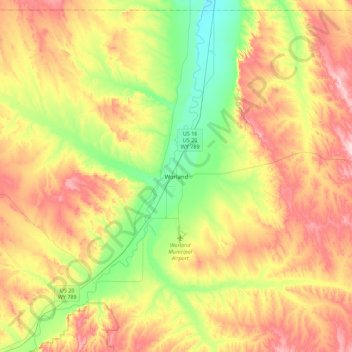
Naam: Topografische kaart Worland, hoogte, reliëf.
Locatie: Worland, Washakie County, Wyoming, 82401, United States (43.85685 -108.11577 44.17685 -107.79577)
Gemiddelde hoogte: 1.319 m
Minimale hoogte: 1.203 m
Maximale hoogte: 1.461 m
Worland experiences an arid climate (Köppen BWk), but one which is quite distinct from much of the state. Due to the location within the Big Horn Basin, it is protected from severe weather by the surrounding mountains from nearly every direction. This topography results in weather that is highly continental with frigid and dry winters, little rainfall and few storms.