
Topografische kaart Glendive
Interactieve kaart
Klik op de kaart om de hoogte weer te geven.
Over deze kaart
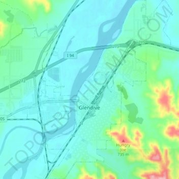
Naam: Topografische kaart Glendive, hoogte, reliëf.
Locatie: Glendive, Dawson County, Montana, 59330, United States (47.08425 -104.73924 47.13675 -104.67647)
Gemiddelde hoogte: 647 m
Minimale hoogte: 620 m
Maximale hoogte: 771 m
The elevation of the city is 2,064 feet (629 m). Interstate 94 passes through town with access from exits 215, 224 and 231. Montana Highway 16 begins in West Glendive. The Yellowstone River cuts through town.