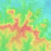
Topografische kaart Paxton
Klik op de kaart om de hoogte weer te geven.
Paxton
Paxton is a town in Walton County, Florida, United States. Located near Britton Hill on the Alabama–Florida state line, it has the highest elevation of any in Florida. The Town of Paxton is located on the Florida Panhandle, and is part of the Crestview–Fort Walton Beach–Destin, Florida Metropolitan Statistical Area. The population was 556 as of the 2020 census, down from 644 at the 2010 census.
Over deze kaart

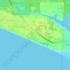
Naam: Topografische kaart Paxton, hoogte, reliëf.
Locatie: Paxton, Walton County, Florida, United States (30.90589 -86.32645 30.99406 -86.28875)
Gemiddelde hoogte: 82 m
Minimale hoogte: 54 m
Maximale hoogte: 109 m
Andere topografische kaarten
Klik op een kaart om zijn topografie, zijn hoogte en zijn reliëf te bekijken.

Britton Hill
United States > Florida > Walton County
Britton Hill is the highest natural point in the state of Florida, United States, with a summit elevation of 345 feet (105 meters) above mean sea level. Britton Hill is the lowest state highpoint in the United States, 103 feet (31 m) lower than the next lowest highpoint, Ebright Azimuth in Delaware, and far…
Gemiddelde hoogte: 93 m





Britton Hill
United States > Florida > Walton County
Britton Hill is the highest natural point in the state of Florida, United States, with a summit elevation of 345 feet (105 meters) above mean sea level. Britton Hill is the lowest state highpoint in the United States, 103 feet (31 m) lower than the next lowest highpoint, Ebright Azimuth in Delaware, and far…
Gemiddelde hoogte: 93 m


Choctaw Beach Community Center Park
United States > Florida > Walton County > Freeport > Choctaw Beach
Gemiddelde hoogte: 7 m