
Topografische kaart Manchester
Interactieve kaart
Klik op de kaart om de hoogte weer te geven.
Over deze kaart
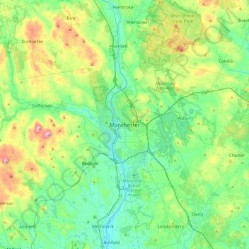
Naam: Topografische kaart Manchester, hoogte, reliëf.
Gemiddelde hoogte: 126 m
Minimale hoogte: 28 m
Maximale hoogte: 400 m
According to the United States Census Bureau, the city has a total area of 35.0 square miles (90.6 km2), of which 33.1 square miles (85.7 km2) are land and 1.9 square miles (4.8 km2) are water, comprising 5.33% of the city. Manchester is drained by the Merrimack River and its tributaries the Piscataquog River and Cohas Brook. Massabesic Lake is on the eastern border. The highest point in Manchester is atop Wellington Hill, where the elevation reaches 570 feet (170 m) above sea level.
Andere topografische kaarten
Klik op een kaart om zijn topografie, zijn hoogte en zijn reliëf te bekijken.
Massabesic Lake
United States > New Hampshire > Hillsborough County > Manchester
Massabesic Lake, Manchester, Hillsborough County, New Hampshire, United States
Gemiddelde hoogte: 90 m