
Topografische kaart Soča
Interactieve kaart
Klik op de kaart om de hoogte weer te geven.
Soča
An Alpine river in character, its source lies in the Trenta Valley in the Julian Alps in northwestern Slovenia, at an elevation of 876 metres (2,874 ft). The river runs past the towns of Bovec, Kobarid, Tolmin, Kanal ob Soči, Nova Gorica (where it is crossed by the Solkan Bridge), and Gorizia, entering the Adriatic Sea close to the town of Monfalcone. It has a nival-pluvial regime in its upper course and pluvial-nival in its lower course.
Over deze kaart
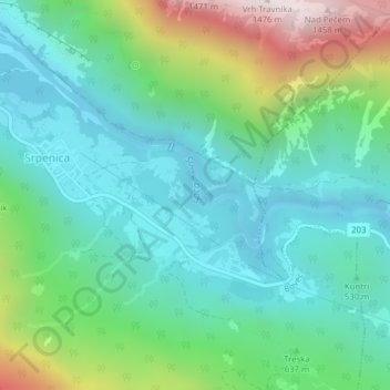
Naam: Topografische kaart Soča, hoogte, reliëf.
Locatie: Soča, Ograjenca, Srpenica, Bovec, 5224, Slovenia (46.28560 13.50800 46.29243 13.51956)
Gemiddelde hoogte: 622 m
Minimale hoogte: 316 m
Maximale hoogte: 1.474 m