
Topografische kaart Ghatsila
Interactieve kaart
Klik op de kaart om de hoogte weer te geven.
Over deze kaart
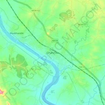
Naam: Topografische kaart Ghatsila, hoogte, reliëf.
Gemiddelde hoogte: 107 m
Minimale hoogte: 71 m
Maximale hoogte: 205 m
Ghatshila is located at 22°36′N 86°29′E / 22.60°N 86.48°E / 22.60; 86.48. It has an average elevation of 103 m (338 ft).