
Topografische kaart Ostrzeszów
Interactieve kaart
Klik op de kaart om de hoogte weer te geven.
Over deze kaart
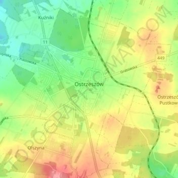
Naam: Topografische kaart Ostrzeszów, hoogte, reliëf.
Gemiddelde hoogte: 213 m
Minimale hoogte: 171 m
Maximale hoogte: 262 m
Andere topografische kaarten
Klik op een kaart om zijn topografie, zijn hoogte en zijn reliëf te bekijken.
Kobyla Góra
Poland > Greater Poland Voivodeship > Ostrzeszów County
Kobyla Góra, gmina Kobyla Góra, Ostrzeszów County, Greater Poland Voivodeship, 63-507, Poland
Gemiddelde hoogte: 220 m