
Topografische kaart Lake Columbia
Interactieve kaart
Klik op de kaart om de hoogte weer te geven.
Over deze kaart
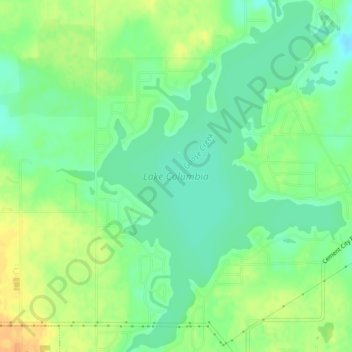
Naam: Topografische kaart Lake Columbia, hoogte, reliëf.
Gemiddelde hoogte: 307 m
Minimale hoogte: 292 m
Maximale hoogte: 326 m
Lake Columbia is a small man-made lake in Columbia Township in southern Jackson County in the U.S. state of Michigan. Originally formed as a mill pond in 1836, it was expanded to 840 acres (3.4 km2) in 1961. At its greatest extent, the lake is 2 and 1/4 miles long and 1 and 3/4 miles wide. It has approximately 14 miles (23 km) of shoreline and the water source to the lake is Goose Creek. The lake has an average depth of 18 feet (5.5 m). Lake Columbia is located 2 miles (3.2 km) west of Brooklyn, Michigan. The latitude for the lake is 42.0928 and the longitude is -84.3011 with an elevation of 988 ft (301 m) above sea level.