
Topografische kaart Chadron
Interactieve kaart
Klik op de kaart om de hoogte weer te geven.
Chadron
Chadron is located at 3,400 feet in elevation. It is surrounded by prairie grassland, broken by a ridge of lightly forested hills to the south.
Over deze kaart
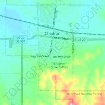
Naam: Topografische kaart Chadron, hoogte, reliëf.
Gemiddelde hoogte: 1.052 m
Minimale hoogte: 1.013 m
Maximale hoogte: 1.181 m