
Topografische kaart Osuchów
Interactieve kaart
Klik op de kaart om de hoogte weer te geven.
Over deze kaart
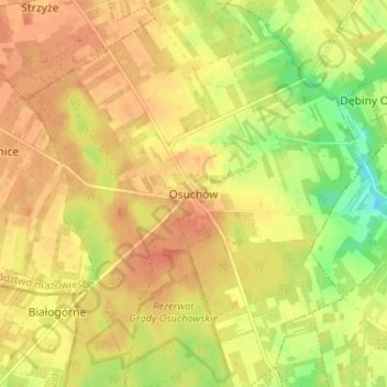
Naam: Topografische kaart Osuchów, hoogte, reliëf.
Gemiddelde hoogte: 199 m
Minimale hoogte: 173 m
Maximale hoogte: 212 m
Andere topografische kaarten
Klik op een kaart om zijn topografie, zijn hoogte en zijn reliëf te bekijken.
Osuchów
Poland > Masovian Voivodeship > Osuchów
Osuchów, gmina Promna, Białobrzegi County, Masovian Voivodeship, Poland
Gemiddelde hoogte: 124 m