
Topografische kaart Tacuarembó
Interactieve kaart
Klik op de kaart om de hoogte weer te geven.
Over deze kaart
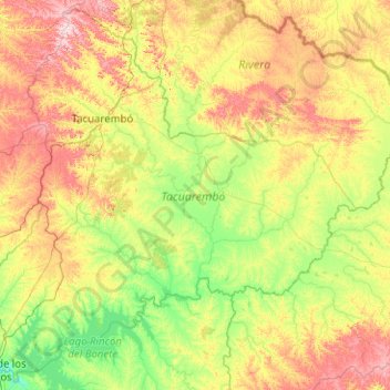
Naam: Topografische kaart Tacuarembó, hoogte, reliëf.
Locatie: Tacuarembó, Uruguay (-32.86648 -56.68328 -31.23071 -54.66736)
Gemiddelde hoogte: 154 m
Minimale hoogte: 56 m
Maximale hoogte: 416 m
Llega a poseer en su topografía la cantidad de 150 cerros, 30 de ellos con características históricas.