
Topografische kaart Ravangla
Interactieve kaart
Klik op de kaart om de hoogte weer te geven.
Over deze kaart
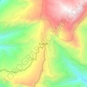
Naam: Topografische kaart Ravangla, hoogte, reliëf.
Locatie: Ravangla, Ravong, Namchi District, Sikkim, 737139, India (27.26513 88.32447 27.34513 88.40447)
Gemiddelde hoogte: 1.870 m
Minimale hoogte: 682 m
Maximale hoogte: 3.229 m
Ravangla or Rawangla or Ravongla is a small tourist town with an elevation of 8000 feet located in the South Sikkim district of the Indian state of Sikkim. It is connected by state highway to other major towns in the state and lies between Pelling and Gangtok. It is the starting point for the trek to Maenam Wildlife Sanctuary. It is approximately 65 km from the state capital, Gangtok, and 120 km from Siliguri, West Bengal. The name is derived from the Bhutia language. ‘Ra’ means wild sheep, 'vong' translates to a rearing place, and ‘la’ means a pass.