
Topografische kaart Étang de Bethmale
Interactieve kaart
Klik op de kaart om de hoogte weer te geven.
Over deze kaart
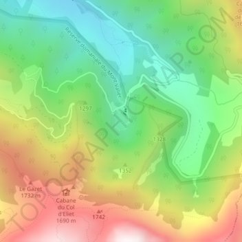
Naam: Topografische kaart Étang de Bethmale, hoogte, reliëf.
Gemiddelde hoogte: 1.307 m
Minimale hoogte: 819 m
Maximale hoogte: 1.995 m
Andere topografische kaarten
Klik op een kaart om zijn topografie, zijn hoogte en zijn reliëf te bekijken.
Les Lauzets
France > Occitanie > Ariège > Bethmale
Les Lauzets, Bethmale, Saint-Girons, Ariège, Occitanie, France métropolitaine, 09800, France
Gemiddelde hoogte: 2.191 m