
Topografische kaart La Union
Interactieve kaart
Klik op de kaart om de hoogte weer te geven.
Over deze kaart
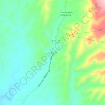
Naam: Topografische kaart La Union, hoogte, reliëf.
Locatie: La Union, San Francisco de Borja, Chihuahua, México (27.92068 -106.67645 27.96068 -106.63645)
Gemiddelde hoogte: 1.752 m
Minimale hoogte: 1.660 m
Maximale hoogte: 1.977 m