

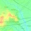
Topografische kaart Surbodi
Klik op de kaart om de hoogte weer te geven.
Over deze kaart

Naam: Topografische kaart Surbodi, hoogte, reliëf.
Locatie: Surbodi, Brahmapuri Taluka, Chandrapur, Maharashtra, India (20.59577 79.89225 20.63577 79.93225)
Gemiddelde hoogte: 222 m
Minimale hoogte: 214 m
Maximale hoogte: 227 m
Andere topografische kaarten
Klik op een kaart om zijn topografie, zijn hoogte en zijn reliëf te bekijken.
Bramhapuri Town
India > Maharashtra > Brahmapuri Taluka
Bramhapuri is one of the six divisions located in the northeastern part of Chandrapur district, Maharashtra at 20°22′N 79°31′E / 20.36°N 79.51°E / 20.36; 79.51 and has an average elevation of 229.5 metres (753 feet). The town is located in the 73rd Vidhan Sabha constituency in Maharashtra.
Gemiddelde hoogte: 226 m