
Topografische kaart Weatherford
Interactieve kaart
Klik op de kaart om de hoogte weer te geven.
Over deze kaart
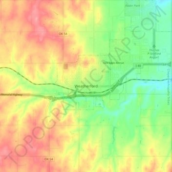
Naam: Topografische kaart Weatherford, hoogte, reliëf.
Locatie: Weatherford, Custer County, Oklahoma, 73096, United States (35.48616 -98.74757 35.56616 -98.66757)
Gemiddelde hoogte: 517 m
Minimale hoogte: 470 m
Maximale hoogte: 562 m
Weatherford is located at 35°32′18″N 98°41′14″W / 35.53833°N 98.68722°W / 35.53833; -98.68722 (35.5384097, -98.6872467). The elevation is 1,634 feet (498 m). According to the United States Census Bureau, the city has a total area of 7.05 square miles (18.3 km2), all land.