
Topografische kaart Horná Lehota
Interactieve kaart
Klik op de kaart om de hoogte weer te geven.
Over deze kaart
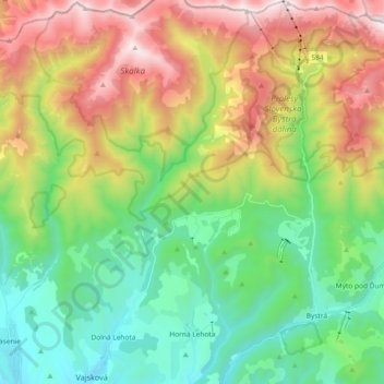
Naam: Topografische kaart Horná Lehota, hoogte, reliëf.
Gemiddelde hoogte: 1.032 m
Minimale hoogte: 469 m
Maximale hoogte: 2.014 m
Andere topografische kaarten
Klik op een kaart om zijn topografie, zijn hoogte en zijn reliëf te bekijken.
Sedmák
Slovakia > Region of Banská Bystrica > District of Brezno > Čierny Balog
Gemiddelde hoogte: 924 m