
Bedankt voor het steunen van deze site ❤️
Doe een donatie
Doe een donatie
Rust jezelf uit voor je volgende avontuur:
Als Amazon-partner verdient deze site een commissie op in aanmerking komende aankopen, zonder extra kosten voor jou.
Topografische kaart o
Klik op de kaart om de hoogte weer te geven.
Bedankt voor het steunen van deze site ❤️
Doe een donatie
Doe een donatie
Rust jezelf uit voor je volgende avontuur:
Als Amazon-partner verdient deze site een commissie op in aanmerking komende aankopen, zonder extra kosten voor jou.
Over deze kaart
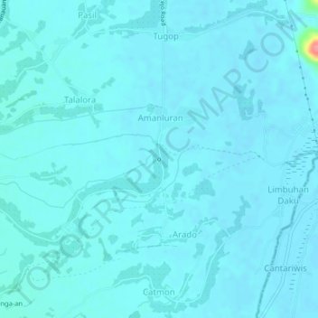
Naam: Topografische kaart o, hoogte, reliëf.
Gemiddelde hoogte: 7 m
Minimale hoogte: 1 m
Maximale hoogte: 84 m
Bedankt voor het steunen van deze site ❤️
Doe een donatie
Doe een donatie
Rust jezelf uit voor je volgende avontuur:
Als Amazon-partner verdient deze site een commissie op in aanmerking komende aankopen, zonder extra kosten voor jou.