
Topografische kaart Łazy Wielkie
Interactieve kaart
Klik op de kaart om de hoogte weer te geven.
Over deze kaart
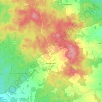
Naam: Topografische kaart Łazy Wielkie, hoogte, reliëf.
Gemiddelde hoogte: 178 m
Minimale hoogte: 121 m
Maximale hoogte: 235 m
Andere topografische kaarten
Klik op een kaart om zijn topografie, zijn hoogte en zijn reliëf te bekijken.
Milicz
Poland > Lower Silesian Voivodeship > Milicz County
Milicz, gmina Milicz, Milicz County, Lower Silesian Voivodeship, 56-300, Poland
Gemiddelde hoogte: 115 m