
Topografische kaart Larwill
Interactieve kaart
Klik op de kaart om de hoogte weer te geven.
Over deze kaart
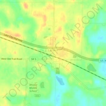
Naam: Topografische kaart Larwill, hoogte, reliëf.
Locatie: Larwill, Whitley County, Indiana, United States (41.17594 -85.62979 41.18382 -85.61589)
Gemiddelde hoogte: 288 m
Minimale hoogte: 270 m
Maximale hoogte: 301 m
Andere topografische kaarten
Klik op een kaart om zijn topografie, zijn hoogte en zijn reliëf te bekijken.
Columbia City
United States > Indiana > Whitley County > Columbia City > Columbia City
Columbia City, Whitley County, Indiana, 26725, United States
Gemiddelde hoogte: 260 m
Columbia City
United States > Indiana > Whitley County
Columbia City, Whitley County, Indiana, 46725, United States
Gemiddelde hoogte: 261 m