
Topografische kaart Visapur
Interactieve kaart
Klik op de kaart om de hoogte weer te geven.
Over deze kaart
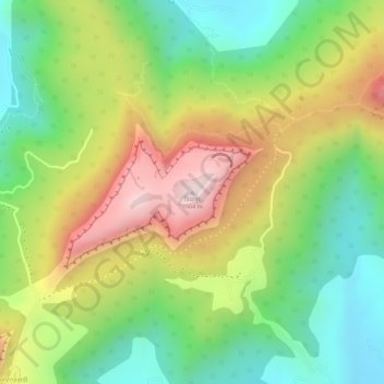
Naam: Topografische kaart Visapur, hoogte, reliëf.
Gemiddelde hoogte: 822 m
Minimale hoogte: 611 m
Maximale hoogte: 1.076 m
It is located in Pune district, 5 to 6 km from Malavli Railway station out of which 3 km is steep road. It has an elevation of 1084 meters above sea level. It is built on the same plateau as Lohagad.