

Topografische kaart Appleton
Klik op de kaart om de hoogte weer te geven.
Over deze kaart
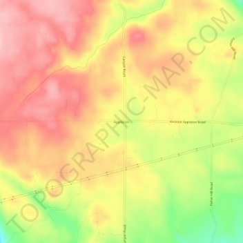
Naam: Topografische kaart Appleton, hoogte, reliëf.
Gemiddelde hoogte: 720 m
Minimale hoogte: 613 m
Maximale hoogte: 787 m
Andere topografische kaarten
Klik op een kaart om zijn topografie, zijn hoogte en zijn reliëf te bekijken.


Columbia River Gorge National Scenic Area
United States > Washington > Klickitat County
The Columbia River, Klamath River in northern California, Pit River in northern California, and Fraser River in southern British Columbia are the only four rivers connecting the watersheds on the east side of the Cascade Range to the Pacific Ocean. Each river has carved out a gorge through the Cascades. The…
Gemiddelde hoogte: 723 m


Goldendale
United States > Washington > Klickitat County
Goldendale's elevation at the County Courthouse is 498 meters (1,634 feet).
Gemiddelde hoogte: 514 m

Observatory Hill State Park
United States > Washington > Klickitat County > Goldendale
Gemiddelde hoogte: 540 m


Goldendale
United States > Washington > Klickitat County
Goldendale's elevation at the County Courthouse is 498 meters (1,634 feet).
Gemiddelde hoogte: 514 m