
Topografische kaart Lansing
Interactieve kaart
Klik op de kaart om de hoogte weer te geven.
Over deze kaart
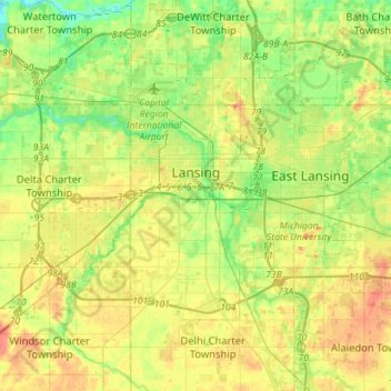
Naam: Topografische kaart Lansing, hoogte, reliëf.
Locatie: Lansing, Ingham County, Michigan, United States (42.64748 -84.70128 42.79498 -84.41758)
Gemiddelde hoogte: 263 m
Minimale hoogte: 239 m
Maximale hoogte: 294 m
Lansing elevations range between 890 feet (271 m) above sea level on the far south side of Lansing along Northrup Street near the Cedar Street intersection, to 833 feet (254 m) to 805.5 feet (246 m) above sea level along the Grand River.
Andere topografische kaarten
Klik op een kaart om zijn topografie, zijn hoogte en zijn reliëf te bekijken.
East Lansing
United States > Michigan > Ingham County
East Lansing, Ingham County, Michigan, United States
Gemiddelde hoogte: 261 m
Williamston
United States > Michigan > Ingham County
Williamston, Ingham County, Michigan, 48895, United States
Gemiddelde hoogte: 268 m
Lansing Charter Township
United States > Michigan > Ingham County
Lansing Charter Township, Ingham County, Michigan, United States
Gemiddelde hoogte: 262 m
North Aurelius
United States > Michigan > Ingham County > North Aurelius
North Aurelius, Aurelius Township, Ingham County, Michigan, United States
Gemiddelde hoogte: 277 m
Mason
United States > Michigan > Ingham County > Mason
Mason, Ingham County, Michigan, 48854, United States
Gemiddelde hoogte: 276 m
Okemos
United States > Michigan > Ingham County > Okemos
Okemos, Meridian Charter Township, Ingham County, Michigan, United States
Gemiddelde hoogte: 264 m