
Topografische kaart Bagalangit
Interactieve kaart
Klik op de kaart om de hoogte weer te geven.
Over deze kaart
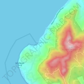
Naam: Topografische kaart Bagalangit, hoogte, reliëf.
Locatie: Bagalangit, Mabini, Batangas, Calabarzon, Philippines (13.70548 120.86457 13.74548 120.90457)
Gemiddelde hoogte: 121 m
Minimale hoogte: 0 m
Maximale hoogte: 494 m