
Topografische kaart Oakhurst
Interactieve kaart
Klik op de kaart om de hoogte weer te geven.
Over deze kaart
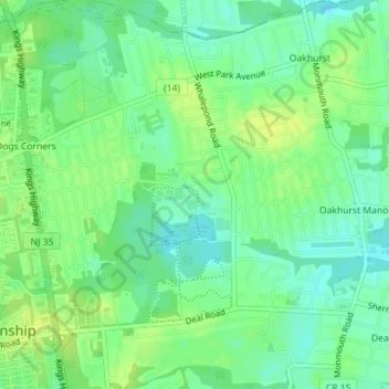
Naam: Topografische kaart Oakhurst, hoogte, reliëf.
Gemiddelde hoogte: 15 m
Minimale hoogte: 6 m
Maximale hoogte: 23 m
According to the United States Census Bureau, the CDP had a total area of 1.614 square miles (4.178 km2), including 1.611 square miles (4.171 km2) of land and 0.003 square miles (0.006 km2) of water (0.16%). The CDP also has an elevation of 46 feet above sea level.