
Topografische kaart Trascastro
Interactieve kaart
Klik op de kaart om de hoogte weer te geven.
Over deze kaart
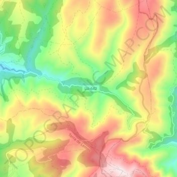
Naam: Topografische kaart Trascastro, hoogte, reliëf.
Locatie: Trascastro, O Incio, Sarria, Lugo, Galicia, 27347, Spain (42.60808 -7.34257 42.66676 -7.26927)
Gemiddelde hoogte: 896 m
Minimale hoogte: 541 m
Maximale hoogte: 1.298 m