
Topografische kaart Chandipur
Interactieve kaart
Klik op de kaart om de hoogte weer te geven.
Chandipur
Chandipur is located at 21°28′N 87°01′E / 21.47°N 87.02°E / 21.47; 87.02. It has an average elevation of 3 m (9.8 ft). This town is 51.330 acres (0.20773 km2) in size. Chandipur beach can be submerged at high tide.
Over deze kaart
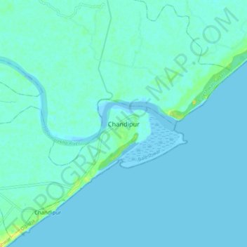
Naam: Topografische kaart Chandipur, hoogte, reliëf.
Gemiddelde hoogte: 3 m
Minimale hoogte: -2 m
Maximale hoogte: 21 m