
Topografische kaart Santa Eugènia
Interactieve kaart
Klik op de kaart om de hoogte weer te geven.
Over deze kaart
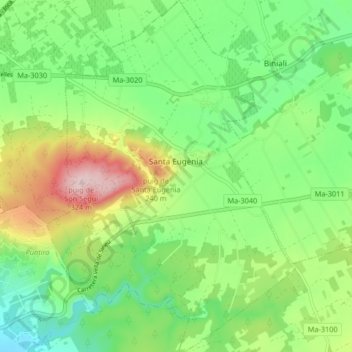
Naam: Topografische kaart Santa Eugènia, hoogte, reliëf.
Locatie: Santa Eugènia, Pla de Mallorca, Islas Baleares, España (39.58832 2.80628 39.65180 2.86497)
Gemiddelde hoogte: 130 m
Minimale hoogte: 28 m
Maximale hoogte: 318 m