
Topografische kaart Podczasza Wola
Interactieve kaart
Klik op de kaart om de hoogte weer te geven.
Over deze kaart
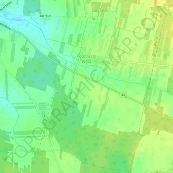
Naam: Topografische kaart Podczasza Wola, hoogte, reliëf.
Gemiddelde hoogte: 168 m
Minimale hoogte: 156 m
Maximale hoogte: 179 m
Andere topografische kaarten
Klik op een kaart om zijn topografie, zijn hoogte en zijn reliëf te bekijken.
Wysokin
Poland > Masovian Voivodeship > Przysucha County
Wysokin, gmina Odrzywół, Przysucha County, Masovian Voivodeship, 26-425, Poland
Gemiddelde hoogte: 152 m
Kozłowiec
Poland > Masovian Voivodeship > Przysucha County
Kozłowiec, gmina Przysucha, Przysucha County, Masovian Voivodeship, Poland
Gemiddelde hoogte: 264 m
Przysucha
Poland > Masovian Voivodeship > Przysucha County > Przysucha > Przysucha
Przysucha, gmina Przysucha, Przysucha County, Masovian Voivodeship, 26-400, Poland
Gemiddelde hoogte: 227 m
Ruski Bród
Poland > Masovian Voivodeship > Przysucha County
Ruski Bród, gmina Przysucha, Przysucha County, Masovian Voivodeship, Poland
Gemiddelde hoogte: 269 m