
Topografische kaart Sheldon Springs
Interactieve kaart
Klik op de kaart om de hoogte weer te geven.
Sheldon Springs
Sheldon Springs is an unincorporated community village in the town of Sheldon in Franklin County, Vermont, United States. It lies at an altitude of 299 feet (91 m). A post office was established in 1871.
Over deze kaart
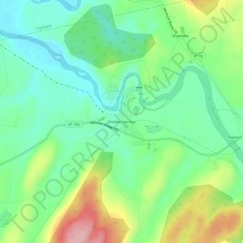
Naam: Topografische kaart Sheldon Springs, hoogte, reliëf.
Gemiddelde hoogte: 118 m
Minimale hoogte: 58 m
Maximale hoogte: 236 m