
Doe een donatie
Rust jezelf uit voor je volgende avontuur:
Als Amazon-partner verdient deze site een commissie op in aanmerking komende aankopen, zonder extra kosten voor jou.
Topografische kaart Little Easton
Klik op de kaart om de hoogte weer te geven.
Doe een donatie
Rust jezelf uit voor je volgende avontuur:
Als Amazon-partner verdient deze site een commissie op in aanmerking komende aankopen, zonder extra kosten voor jou.
Little Easton
Living in the parish were Lord and Lady Brooke, the later Earl and Countess of Warwick, at Easton Lodge, who were also resident at Berwick House in the Stable Yard of St James's Palace, London, and in 1902, after elevation to title, Warwick Castle. Parish occupations in 1882 included three farmers, one of whom was also a miller (water), a farm bailiff, a beer retailer, a fanwright (maker of fans), two shopkeepers, the publican of the Stag Inn, an accountant, an agent to the Earl of Rosslyn, and a clerk to the Easton estates. By 1902 the number of farmers and beer retailers remained the same. The Stag Inn was still operating, and there was a wheelwright, although now only one shopkeeper. There was a Treasurer and Honorary Secretary of the Workmen's Club, and the artists Frank and Charlotte Mura at Mill End studio. The clerk to the Easton estates remained, although the agent to the Earl of Rosslyn didn't.
Doe een donatie
Rust jezelf uit voor je volgende avontuur:
Als Amazon-partner verdient deze site een commissie op in aanmerking komende aankopen, zonder extra kosten voor jou.
Over deze kaart
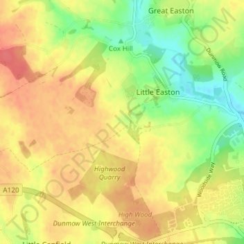
Naam: Topografische kaart Little Easton, hoogte, reliëf.
Locatie: Little Easton, Uttlesford, Essex, England, United Kingdom (51.87375 0.29309 51.90178 0.35401)
Gemiddelde hoogte: 88 m
Minimale hoogte: 56 m
Maximale hoogte: 112 m
Doe een donatie
Rust jezelf uit voor je volgende avontuur:
Als Amazon-partner verdient deze site een commissie op in aanmerking komende aankopen, zonder extra kosten voor jou.