
Topografische kaart Seward Park
Interactieve kaart
Klik op de kaart om de hoogte weer te geven.
Over deze kaart
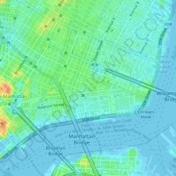
Naam: Topografische kaart Seward Park, hoogte, reliëf.
Gemiddelde hoogte: 10 m
Minimale hoogte: -9 m
Maximale hoogte: 47 m
Andere topografische kaarten
Klik op een kaart om zijn topografie, zijn hoogte en zijn reliëf te bekijken.
Manhattan
United States of America > New York > New York
Koreatown, Manhattan Community Board 5, Manhattan, New York County, New York, United States of America
Gemiddelde hoogte: 19 m
Inwood
United States of America > New York > New York
Inwood, Manhattan Community Board 12, Manhattan, New York County, New York, 10034, United States of America
Gemiddelde hoogte: 21 m
Manhattan
United States of America > New York > New York
Harlem, Manhattan Community Board 10, Manhattan, New York County, New York, United States of America
Gemiddelde hoogte: 16 m
Battle Hill
United States of America > New York > New York
Battle Hill, Battle Path, South Slope, Brooklyn, Kings County, New York, 11215, United States of America
Gemiddelde hoogte: 29 m
WQXR-AM (New York)
United States of America > New York > New York
WQXR-AM (New York), Grand Avenue, Linden Hill, Queens, New York, Queens County, New York, 11373, United States of America
Gemiddelde hoogte: 13 m
WNYC-AM (New York)
United States of America > New York > New York
WNYC-AM (New York), 8, Greenpoint Avenue, Greenpoint, New York, Brooklyn, Kings County, New York, 11222, United States of America
Gemiddelde hoogte: 4 m