
Topografische kaart Langar
Klik op de kaart om de hoogte weer te geven.
Over deze kaart
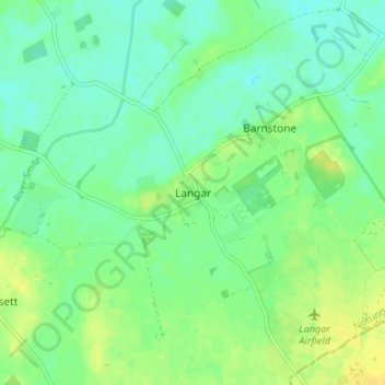
Naam: Topografische kaart Langar, hoogte, reliëf.
Gemiddelde hoogte: 32 m
Minimale hoogte: 23 m
Maximale hoogte: 43 m
Andere topografische kaarten
Klik op een kaart om zijn topografie, zijn hoogte en zijn reliëf te bekijken.
Barton in Fabis
United Kingdom > England > Nottinghamshire > Rushcliffe > Barton-in-Fabis
Gemiddelde hoogte: 39 m
Normanton on the Wolds
United Kingdom > England > Nottinghamshire > Rushcliffe
Gemiddelde hoogte: 59 m
Willoughby on the Wolds
United Kingdom > England > Nottinghamshire > Rushcliffe
Gemiddelde hoogte: 92 m
Archers Lake
United Kingdom > England > Nottinghamshire > Rushcliffe > Bingham
Gemiddelde hoogte: 28 m
Elton-on-the-Hill
United Kingdom > England > Nottinghamshire > Rushcliffe
Elton lies about 14 miles (23 km) east of Nottingham. It straddles the A52 trunk road, from which Station Road runs north towards Orston and Sutton Lane south, with Sutton-cum-Granby being the nearest hamlet in that direction. Elton has a population of 114 people and is in the Rushcliffe district. It has an…
Gemiddelde hoogte: 29 m
Clipston
United Kingdom > England > Nottinghamshire > Rushcliffe
Clipston stands on the northernmost edge of the Wolds in Nottinghamshire. The area enjoys, from an elevation of about 79 m/259 ft, panoramic views of the Trent valley and the East and South side of the city of Nottingham, some 50 m/164 ft lower. Nearby to the west is Hoe Hill, with a horseshoe-shaped wood.
Gemiddelde hoogte: 59 m
Colston Bassett
United Kingdom > England > Nottinghamshire > Rushcliffe > Colston Bassett
Gemiddelde hoogte: 39 m