
Topografische kaart Hezuo
Interactieve kaart
Klik op de kaart om de hoogte weer te geven.
Hezuo
With an elevation of nearly 3,000 metres (9,800 ft), Hezuo has an alpine subarctic climate (Köppen Dwc), with long, very cold, dry winters, and short, mild summers. The monthly daily mean temperature in January, the coldest month, is −9.3 °C (15.3 °F), while the same figure for July, the warmest month, is 13.3 °C (55.9 °F); the annual mean is 2.82 °C (37.1 °F). Most of the annual precipitation is delivered from May to September. With monthly percent possible sunshine ranging from 44% in June and September to 71% in December, the city receives 2,370 hours of bright sunshine annually.
Over deze kaart
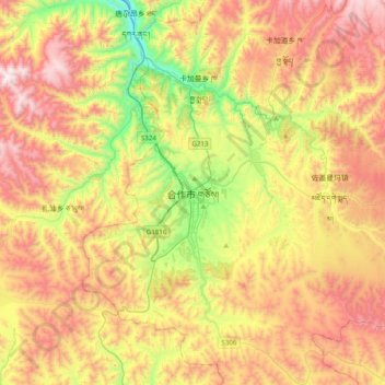
Naam: Topografische kaart Hezuo, hoogte, reliëf.
Gemiddelde hoogte: 3.198 m
Minimale hoogte: 2.630 m
Maximale hoogte: 3.833 m