

Topografische kaart Loxahatchee Groves
Klik op de kaart om de hoogte weer te geven.
Loxahatchee Groves
The area now known as Loxahatchee Groves was originally a portion of the 2,000,000 acres (8,100 km2) of land purchased by the Southern States Land and Timber Company in 1902. After the West Palm Beach Canal (C-51), which connected Lake Okeechobee at Canal Point to West Palm Beach, was completed in 1917, George Frederick Bensel, the Southern States sales manager, envisioned a "waterfront" farming community along the canal. Bensel, and company engineer Torvald Garfield "T. G." Thorgesen, created the first topographical map of Loxahatchee Groves during the following three years. Bensel, Thorgesen, and others then established the Palm Beach Loxahatchee Company, and bought 6,500 acres (26 km2) from the Southern States Land and Timber Company, naming the land "Loxahatchee Farms". The Palm Beach Loxahatchee Company built almost 30 mi (48 km) of canals and roads, which were to be maintained by the Loxahatchee Groves Drainage District, that now is known as the Loxahatchee Groves Water Control District.
Over deze kaart

Naam: Topografische kaart Loxahatchee Groves, hoogte, reliëf.
Gemiddelde hoogte: 9 m
Minimale hoogte: 4 m
Maximale hoogte: 12 m
Andere topografische kaarten
Klik op een kaart om zijn topografie, zijn hoogte en zijn reliëf te bekijken.





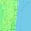
Delray Beach
United States > Florida > Palm Beach County > Delray Beach
Delray Beach has hot and humid summers. High summertime temperatures range from 87-93 °F with low temperatures around 75-78 °F. Winters are warm, with a marked drier season. Typical wintertime high temperatures are typically in the range of 74-83 °F and low temperatures 57-65 °F. However, when occasional…
Gemiddelde hoogte: 4 m





Villages of Oriole
United States > Florida > Palm Beach County > Villages of Oriole
Gemiddelde hoogte: 9 m
Oslo national park
United States > Florida > Palm Beach County > West Palm Beach
Gemiddelde hoogte: 9 m