
Topografische kaart Ballybritt
Interactieve kaart
Klik op de kaart om de hoogte weer te geven.
Over deze kaart
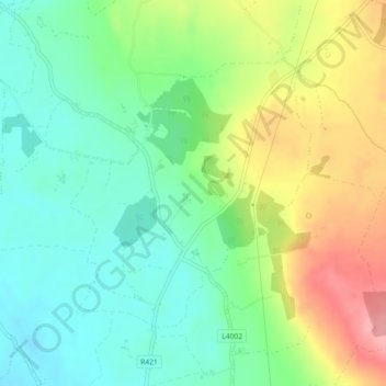
Naam: Topografische kaart Ballybritt, hoogte, reliëf.
Gemiddelde hoogte: 146 m
Minimale hoogte: 106 m
Maximale hoogte: 212 m
Andere topografische kaarten
Klik op een kaart om zijn topografie, zijn hoogte en zijn reliëf te bekijken.
Shinrone
Ireland > County Offaly > The Municipal District of Birr
Shinrone, The Municipal District of Birr, County Offaly, Leinster, Ireland
Gemiddelde hoogte: 72 m
Kilcormac ED
Ireland > County Offaly > The Municipal District of Birr
Kilcormac ED, The Municipal District of Birr, County Offaly, Leinster, R42 RC92, Ireland
Gemiddelde hoogte: 69 m
Seir Kieran
Ireland > County Offaly > The Municipal District of Birr
Seir Kieran, The Municipal District of Birr, County Offaly, Leinster, Ireland
Gemiddelde hoogte: 143 m