
Topografische kaart Purulia - II
Interactieve kaart
Klik op de kaart om de hoogte weer te geven.
Over deze kaart
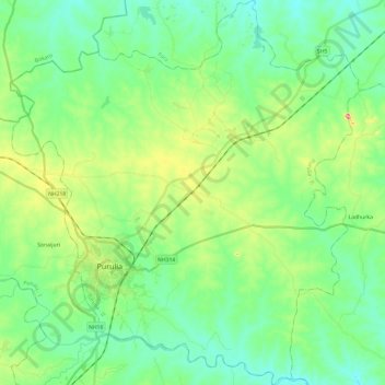
Naam: Topografische kaart Purulia - II, hoogte, reliëf.
Locatie: Purulia - II, Puruliya, West Bengal, India (23.26134 86.30520 23.48135 86.52287)
Gemiddelde hoogte: 230 m
Minimale hoogte: 184 m
Maximale hoogte: 354 m
The Purulia II CD block is located in the central part of the district. The Kangsabati River forms the boundary between the Purulia II and Purulia I CD blocks. The upper Kangsabati basin has undulating land and the elevation rises from 200 to 300 m and the general slope is from west to east and south-east.
Andere topografische kaarten
Klik op een kaart om zijn topografie, zijn hoogte en zijn reliëf te bekijken.
Purulia
India > West Bengal > Purulia - II
Purulia, Purulia - II, Puruliya, West Bengal, 723101, India
Gemiddelde hoogte: 241 m