

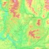
Topografische kaart Locke
Klik op de kaart om de hoogte weer te geven.
Over deze kaart

Naam: Topografische kaart Locke, hoogte, reliëf.
Gemiddelde hoogte: 668 m
Minimale hoogte: 617 m
Maximale hoogte: 835 m
Andere topografische kaarten
Klik op een kaart om zijn topografie, zijn hoogte en zijn reliëf te bekijken.

Ione
United States > Washington > Pend Oreille County
Ione is situated on the west bank of the Pend Oreille River as it flows north towards Canada. Big Muddy Creek, Little Muddy Creek and Cedar Creek, from south to north, join the river in Ione. State Route 31 passes through town. Ione Bridge, on the southern edge of town, is the only road crossing of the Pend…
Gemiddelde hoogte: 670 m

Newport
United States > Washington > Pend Oreille County
Newport is located at an elevation of 2,160 feet (658.5 m) and according to the United States Census Bureau, the city has a total area of 1.07 square miles (2.77 km2), all of it land.
Gemiddelde hoogte: 662 m
Newport
United States > Washington > Pend Oreille County
Newport is located at an elevation of 2,160 feet (658.5 m) and according to the United States Census Bureau, the city has a total area of 1.07 square miles (2.77 km2), all of it land.
Gemiddelde hoogte: 662 m

Ione
United States > Washington > Pend Oreille County
Ione is situated on the west bank of the Pend Oreille River as it flows north towards Canada. Big Muddy Creek, Little Muddy Creek and Cedar Creek, from south to north, join the river in Ione. State Route 31 passes through town. Ione Bridge, on the southern edge of town, is the only road crossing of the Pend…
Gemiddelde hoogte: 670 m


Kalispel Reservation
United States > Washington > Pend Oreille County > Airway Heights
Gemiddelde hoogte: 801 m
