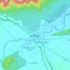
Topografische kaart Bhavani
Klik op de kaart om de hoogte weer te geven.
Bhavani
The Bhavani is a 234 km (145 mi) long perennial river fed by monsoons. The river originates at an altitude of 2,634 m (8,642 ft) in the Billimala range of the Nilgiris in the Western Ghats in Tamil Nadu. It flows westwards towards the Silent Valley National Park in Kerala, before later turning eastwards and flowing through the Attappadi valley in Palakkad district. Later, it re-enters Tamil Nadu, and flows through the districts of Nilgiris, Coimbatore, and Erode. The river basin covers an area of 1,410 km2 (540 sq mi). Various rivulets and tributaries join the Bhavani river during its course. Major tributaries include the Moyar, and Siruvani Rivers. Bhavani is one of the major tributaries of the Kaveri, which it joins at the Kooduthurai near Bhavani.
Over deze kaart

Naam: Topografische kaart Bhavani, hoogte, reliëf.
Locatie: Bhavani, Mettupalayam, Coimbatore, Tamil Nadu, India (11.06546 76.53728 11.46981 77.11411)
Gemiddelde hoogte: 923 m
Minimale hoogte: 242 m
Maximale hoogte: 2.620 m
Andere topografische kaarten
Klik op een kaart om zijn topografie, zijn hoogte en zijn reliëf te bekijken.